
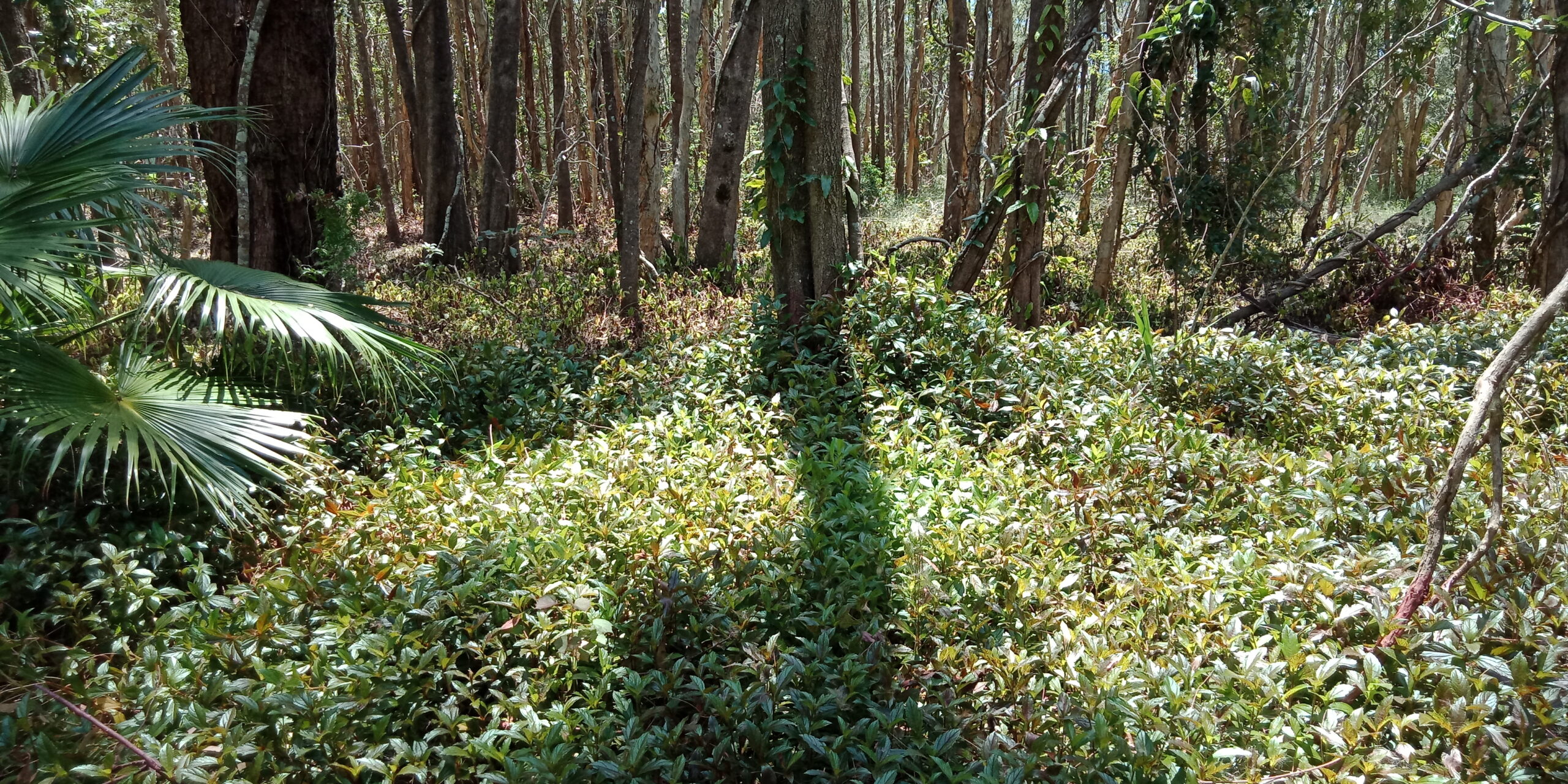
This vegetation type is dominated by paperbarks (Melaleuca spp.). Confined mainly to wetter water courses, dune swales and wetland areas.
The canopy varies from 5m-20m and can be sparse to dense (up to 70% foliage coverage). Woodlands can share canopy with Swamp Mahogany (Eucalyptus robusta), Swamp Brushbox (Lophostemon suaveolens), Queensland Blue Gums (Eucalyptus tereticornis) and Tumblegum (Eucalyptus bancroftii).
The shrub layer is sparse, and ground layer can be dense to sparse, dominated by graminoids, ferns, sedges and forbs. Understory composition is variable depending upon drainage.


Regional Ecosystems
Regional Ecosystems are a Queensland vegetation community classification system and mapping tool developed by the Queensland Government. It incorporates its regional location, the sites underlying geology, landform and soil and the different vegetation that makes up the ecosystem type. This is a more detailed classification of vegetation communities then the broad vegetation communities outlined in this page.
Regional ecosystems can help you identify suitable species for your revegetation project, help with the planning of fire management, weed management etc., identify the types of fauna habitat and fauna species that may be present on the property and identify which vegetation is regrowth or remnant.
Learn more about Regional Ecosystems – here.
Download your properties Regional Ecosystem map and classification – here.
Regional Ecosystem classification examples for this vegetation community in the Noosa Shire (click to download an RE description or factsheet):
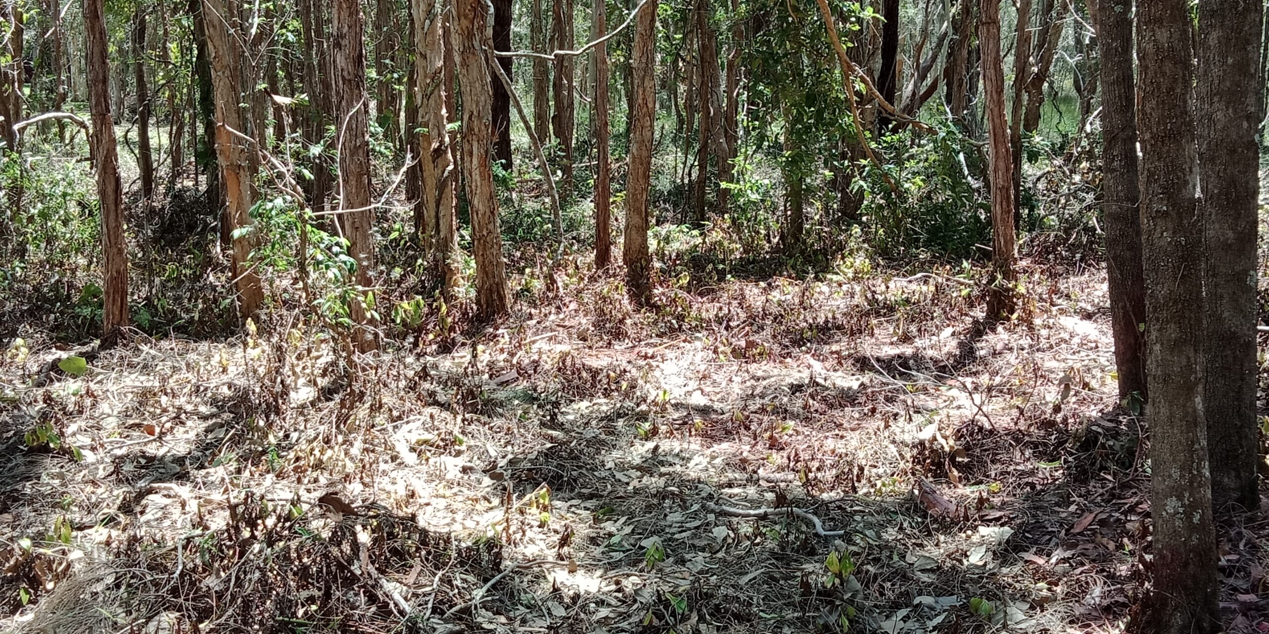
Soil and Geology:
Deep sandy, organic soils, with low clay content.
Relationship with fire:
One of the Paperbark tree’s remarkable adaptations is its ability to survive and regenerate after bushfires. The thick, layered bark protects the inner trunk from the heat, allowing the tree to resprout even after significant damage. High intensity fires may kill Paperbarks and trigger regeneration from seed. Burning will be naturally constrained for much of the time by the presence of lying water.
Regenerating forests and woodlands require long periods (e.g. at least 10 years) free from fire.
Threats:


Values:


Management Considerations:
Land managers are aiming to maintain or restore a native species composition indicative to a Melaleuca woodland and forest and manage pressures such as weeds, fire and nutrient runoff to encourage and protect ecosystem values.
Where barriers to local water run-off or hydrology is evident, landholders are advised to gain advice on appropriate remediation options for the site if viable.
Restoration:
Much of our local landscape has experienced significant changes over time, mainly driven by activities such as land clearing for development and agriculture, as well as extraction industries like mining along the Mary River. The growing pressures from urbanisation and climate change have further exacerbated the impact on our local environment.
As land managers, we can play a vital role in helping preserve the health of the natural environment and restore the ecological balance in areas impacted by past disturbances.
What is Ecological Restoration? Here at Noosa Landcare, we like to follow the definition of Ecological Restoration applied by the Society for Ecological Restoration (SER):
“Ecological restoration is the process of assisting the recovery of an ecosystem that has been degraded, damaged, or destroyed.”
There are three main ecological restoration approaches as identified in the National Standards for the Practice of Ecological Restoration in Australia. These three approaches are usually used alone or combined if appropriate for the site. All will require ongoing adaptive management until recovery is reached.
Where damage is relatively low, pre-existing vegetation should be able to recover with threat removed or stopped.
This approach is suitable for bushland areas that:
Weed-free areas of native vegetation | Native species are naturally regenerating i.e. evidence of a diversity of native seedlings and life stages of plants and animals | Mix of diverse native species indicative to the vegetation community(s) present|
Common threat examples:
Storm disturbance – Flood, Rain and Wind damage | Vegetation clearing | Inappropriate fire regimes and wildfires | Inappropriate grazing regimes | Lack of connectivity |
Management action examples:
Fence bushland area to exclude grazing or adjust grazing regime more effectively to minimise risk of over grazing or damage to native vegetation | Develop and implement a fire management plan | Establish connectivity between bushland areas where viable using the reconstruction approach |
Recovery at sites of intermediate (or even high) degradation. Need both the removal of causes of degradation and further active interventions required to trigger natural regeneration and recovery key ecological features.
This approach is suitable for bushland areas that:
Regrowth or recovering vegetation communities | native plant seed is still available on site or will be able to reach the site from nearby bushland areas, by birds or other animals, wind or water | natural regeneration is being inhibited by external factors, such as weed invasion, soil compaction, cattle grazing, mechanical slashing, etc. | Some key ecological and habitat features missing e.g. tree hollows, shrub layer |
Common threat examples:
Inappropriate fire regimes and wildfires | Inappropriate grazing regimes | Weeds and feral animals | Erosion | Slashing and broadscale chemical spraying|
Management action examples:
Integrated Weed management | Applying disturbances such as fire to break seed dormancy | installing habitat features such as hollow logs, rocks, woody debris piles and perch tree | reshaping and stabilisation of watercourses | Remediating soil chemistry and/or soil structure | Identify emerging trees and shrubs and use slashing and brushcutting practices to aid the reestablishment of the native vegetation. Avoid blanket slashing of areas. | Revegetation may be suitable to reestablish species for genetic diversity purposes or that cannot return to site without direct intervention e.g. rare and threatened species.
Where resilience is depleted, and abiotic or biotic elements need to be reestablished before recovery can commence.
This approach is suitable for bushland areas that:
Areas that have experienced significant, long-standing disturbance that the pre-existing native plant community cannot recover by natural means | Significant weed coverage |
Common threat examples:
Inappropriate fire regimes and wildfires | Inappropriate grazing regimes | Weeds and feral animals | Erosion | Slashing | Clearing | Lack of connectivity |
Management action examples:
Revegetation| Integrated Weed management | reshaping and stabilisation of watercourses | Remediating soil chemistry and/or soil structure |
A note on weeds for this vegetation community:
Proximity of urbanization and altering of local hydrology of the site from drought or man-made barriers can increase the risk of weed incursion. Lantana (Lantana camara), Camphor Laurel (Cinnamomum camphora), Umbrella tree (Schefflera actinophylla), Easter Cassia (Senna pendula var. glabrata) and introduced pasture grasses commonly invade areas that become less waterlogged.
More water tolerant weeds, like Para Grass (Urochloa mutica) and Singapore Daisy (Sphagneticola trilobata), can encroach into bushland areas, even those that appear in good condition. This is particularly high risk with the input of excessive nutrients from nearby urban and agricultural land use.
It is important to establish a weed management plan for your bushland area to take a strategic approach and be more effective with your resources, including your time.
Please visit our weed management page for more information on weed management planning and weed control methods.

Wetland buffers:
A useful tool of protecting wetland biodiversity and ecological values is by maintaining a buffer zone of intact vegetation. Buffer distances range from 50-200 meters.
The buffer is used to reduce the impact from adjacent land uses. Its role is to:
There are specific guidelines for wetland buffer zones under local and state government legislation where development is being undertaken adjacent to the wetland area.